United States Maps Home > United States Map Collection > Western Hawaii Map
Printable Map of Western Hawaii
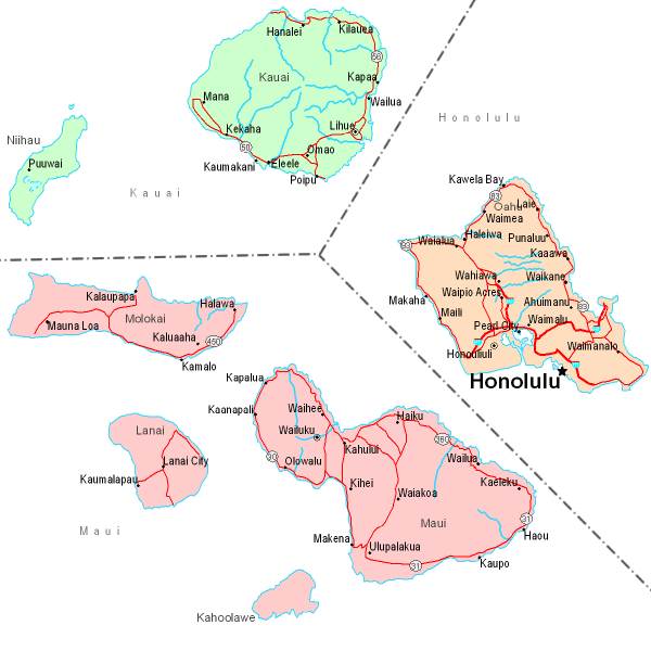
This map is a plain figure presenting the geography of this region with a basic array of map components.
Of course, you can print the map image and utilize it for many purposes. Citing this page would be awesome.
If you need help obtaining a map, a distinct kind of map, or need a great personalized creation, simply contact us.
Procure superior custom maps from us. Cuztomized maps by YellowMaps contain a wholesome combination of map elements, such as: roads, legend, GPS coordinates, bays, lakes, towns, forests, or rapids, etc. Map types go from topo to cartogram, printed to electronic, counties to zip code.
Great maps are accurate, up to date, and not deceptive. Expert map production by YellowMaps.
To order printed maps or charts, like road atlases, tourist maps, or maps for kayaking, you can visit our map store We have a collection of more than 100,000 map products.
We love maps. A grand passion and delight. Show me a good map of the world..., they say.
Back to United States map collection