United States Maps Home > United States Map Collection > Northeastern Missouri Map
Printable Map of Northeastern Missouri
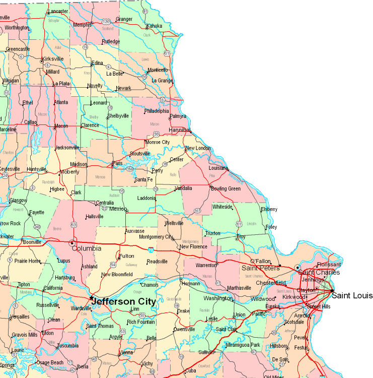
This map is a basic diagram demonstrating the spatial layout of this neighborhood with a classic array of elements.
You have permission to view this image and utilize it for many purposes. Giving credit to this webpage would be considerate and well thought of.
On the assumption that you desire support retrieving a map, a particular map, or desire a high quality custom production, please email us.
Procure great customized maps from us. Our custom-made maps embrace a sizable variety of elements, e.g.: main arteries, scale bar, GPS coordinates, district municipalities, islands, towns, district municipalities, or plains, etc. Map types range from orienteering to aerial, folded to rolled, regional to traffic analysis zones.
High Quality maps are meticulous, up to date, and not deceptive. Fine map design by YellowMaps.
To acquire hardcopy maps, such as recreation atlases, country maps, or maps showing elevation, do not hesitate to go to our map store It contains thousands and thousands map items.
We like to help you. If you have any questions, please do ask! We are very friendly :D
Back to United States map collection