United States Maps Home > United States Map Collection > Southwestern USA Political Detail Map
Printable Map of Southwestern USA Political Detail
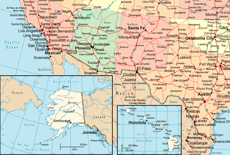
The above is a simple graphic that displays the spatial relationships of this region with a simple collection of elements.
You may view this image and work with it in your research. Giving credit to this webpage is always appreciated. Thank you kindly.
If you call for aid acquiring a map, a different kind of map, or call for a good custom-made map, simply email YellowMaps.
Buy great custom-built maps from us. Our custom maps encompass a refreshing assortment of map elements, for instance: boulevards, map projection, GPS coordinates, district municipalities, marine navigation features, sea features, hamlets, or recreational sites, etc. Map types go from political to satellite, folded to rolled, block groups to economic places.
Good maps are detailed, all-inclusive, and not unclear. First-Rate map-making by YellowMaps.
To procure actual maps that get delivered in the mail to your home, for instance recreation atlases, attractions maps, or maps for kayaking, just visit our online map store We have a collection of over 100,000 products.
Maps are beautiful.
Back to United States map collection