United States Maps Home > United States Map Collection > Eastern South Dakota Map
Printable Map of Eastern South Dakota
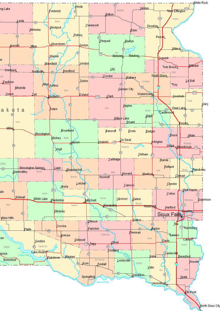
This map is a plain projection showcasing the spatial relationships of this neighborhood with a simple selection of map components.
You are granted permission to print this file and utilize it in your research. Citing this page is our request.
In the case that you wish for assistance retrieving a map, a special kind of map, or wish for a nice custom-made preparation, simply email us.
Procure great made to your specs maps from us. Cuztomized maps by YellowMaps provide a refreshing mixture of elements, for instance: nodes of transportation, scale bar, GPS coordinates, capes, mountains, shoals, glaciers, or river features, etc. Map types range from road to locator, digital to hardcopy, state or province to estates.
Nice maps are specific, well-defined, and not unclear. First-Rate map-making by YellowMaps.
To acquire paper maps, e.g. road atlases, maps of continents, or maps for exploring, simply go to our map shop You can find over 100,000 map products.
Maps are beautiful.
Back to United States map collection